We are staying in Esk for a week attending a Rotary Nomads function and today is a ‘free’ day. This provided a great opportunity walk our first section of the Brisbane Valley Rail Trail (BVRT) from Toogoolawah to Esk. For todays walk Steven teamed up with John who stars in some of the photos.
Click here for an overview of the BVRT
We organised a lift to Toogoolawah on a nice sunny day at 22 Degrees, perfect walking weather!!
Toogoolawah is one of those Australian place names that is derived from Aboriginal words. Toogoolawah is “dhoo” (a generic term for tree) and “goo/lawa”, meaning “crescent shaped” or Tugulawa” meaning a “bend in the river”.
There were a number of ‘Last Runs’ including a stock train after the end of scheduled services on the branch with the very last taking place to Toogoolawah in 1992
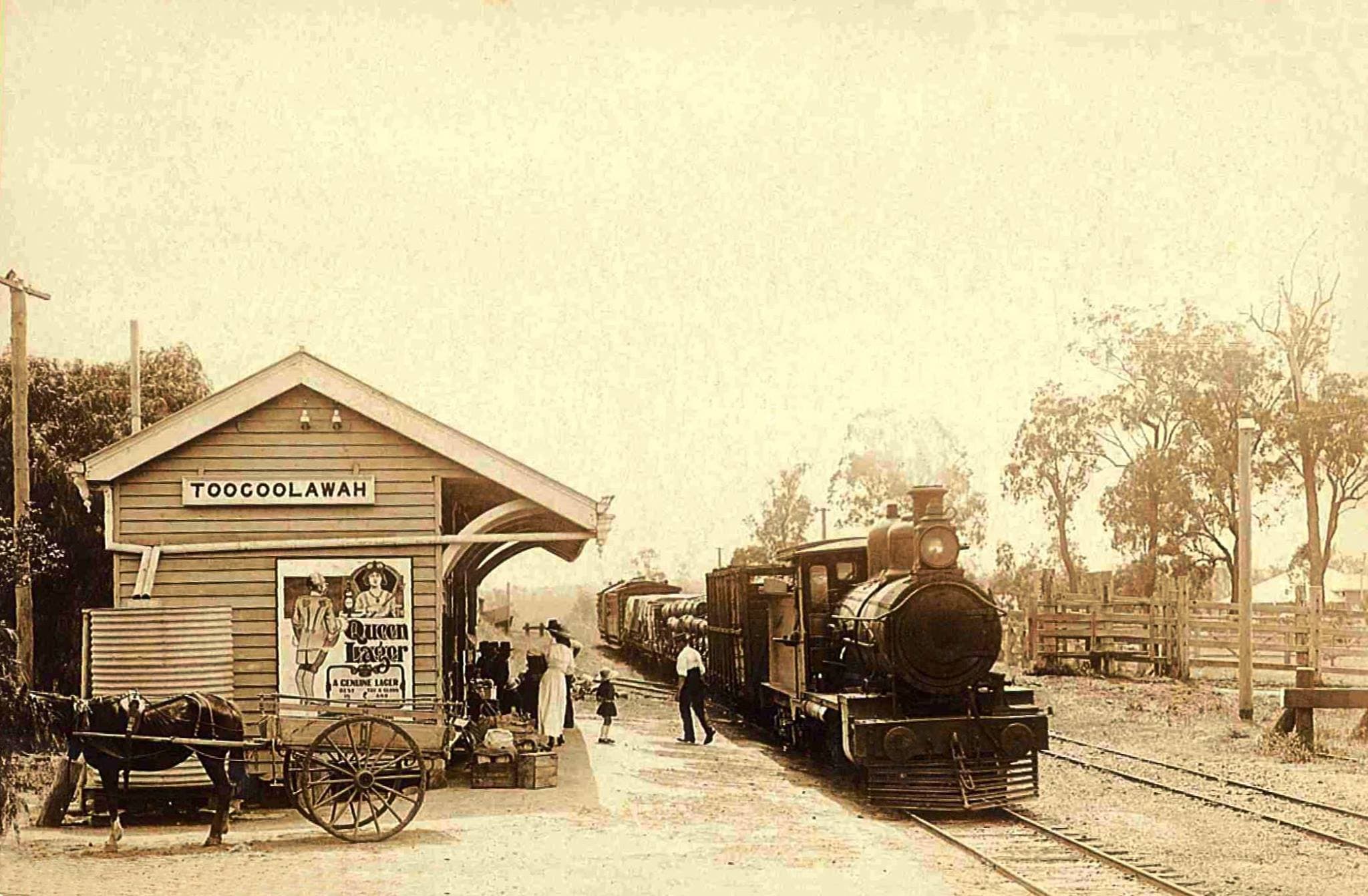
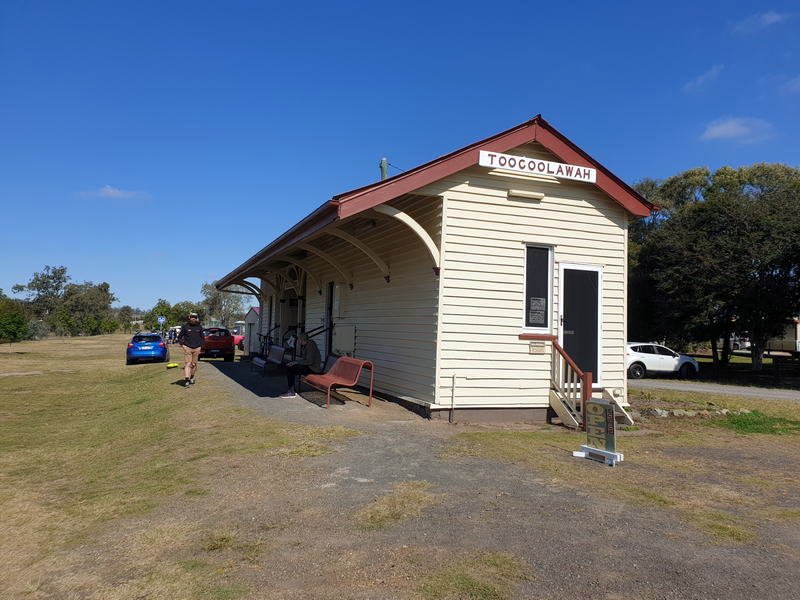
Toogoolawah Station. The line was extended out to Toogoolawah in 1904.
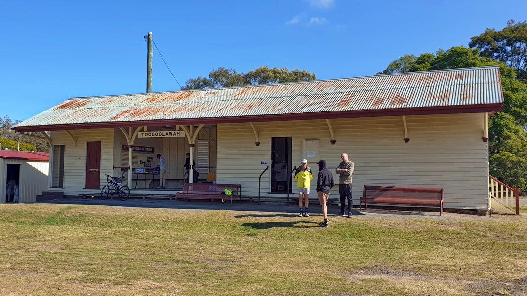
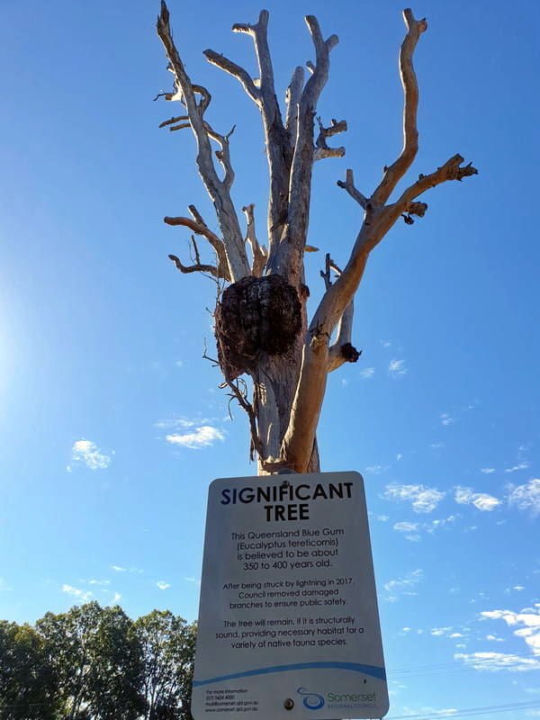
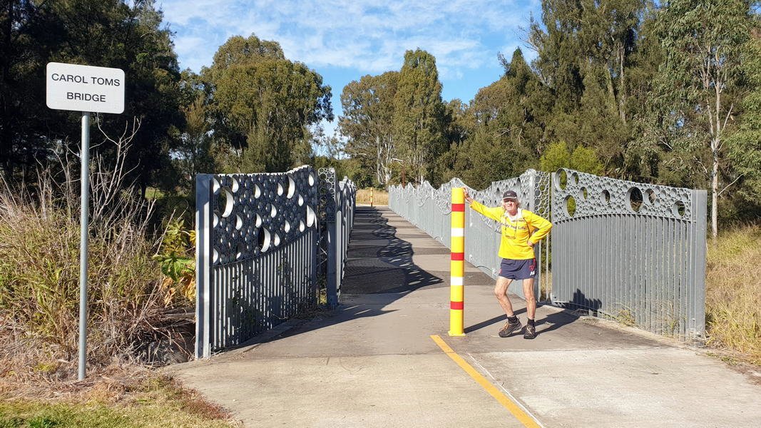
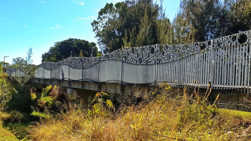
We started walking at 10am and crossed the Toogoolawah Pedestrian Bridge, also known as the Bubble Bridge. Just passed the bridge is a significant tree. We knew it was a significant tree because the sign said so.
The significant tree is a Queensland Blue gum about 350 to 400 years old and was struck by lightning in 2017
This section of the trail travels adjacent to Camp Creek and crosses Cressbrook Creek, a tributary of the Brisbane River, at Toogoolawah. The trail extends through farmland including lucerne, other pasture and small crops that are important to the local economy.
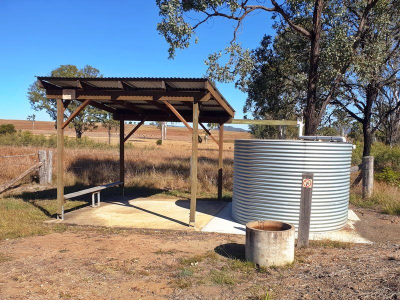
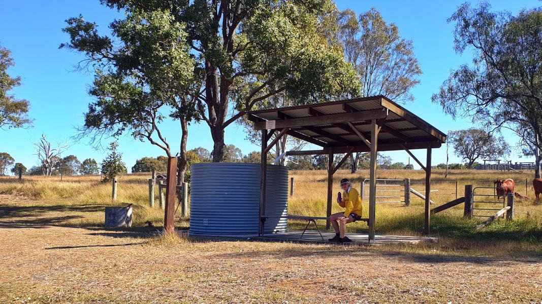
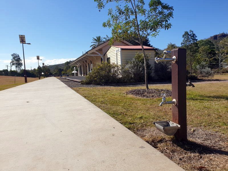
Drinking water stations and toilets are available at Esk and Toogoolawah but there are no toilets or water stations between these towns. There are however two rest areas provided with water troughs for horses but the water here is non-potable and unsuitable for us humans.
The local advice is that the almost 20 km distance and lack of trail facilities make this section suitable for people with a moderate to high fitness level. We found the going quite easy. John is a fast walker so we completed the 19.55 km in 3hr 51m with an elevation gain of 134 Metres. Surface is a mixture of dirt and gravel and is mostly flat, with a couple of small gullies when going around the old rail bridges. There are however long sections which are very exposed with no shade. If walking in hot weather the carrying additional water needs to be seriously considered.
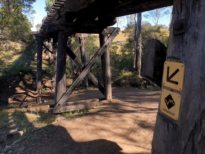
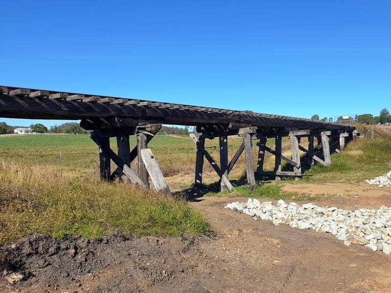
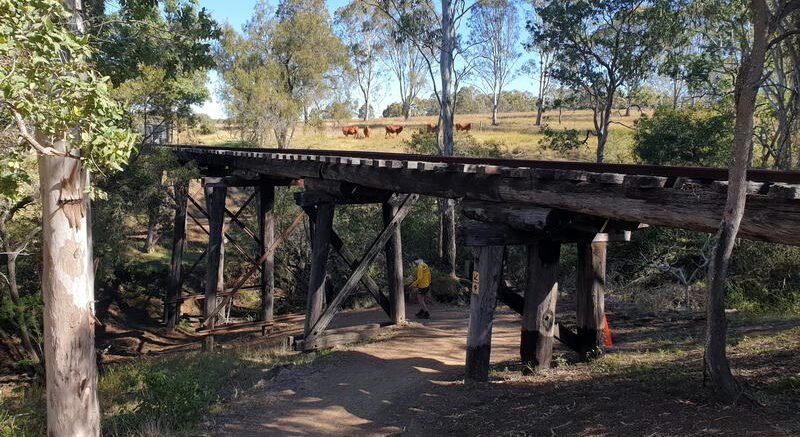
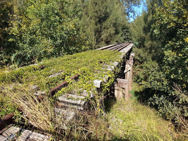
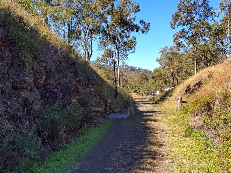
There several old wooden trestle bridges in this section. Unfortunately none were able to be crossed and the trail goes around them or down into the creek and up the other side. These areas have an ‘Advanced’ sign even if the dip was quite small. The track may have been a little rougher though.
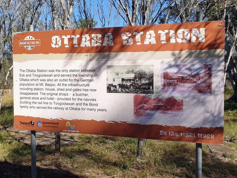
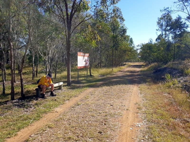
Stopped at Ottaba station for a break. Little left of the station now other than the information sign and some embankments and old twisted metal. There was a TRAGEDY AT OTTABA STATION – 25th APRIL, 1929 when the remains of William Varley were found strewn along the Brisbane Valley Railway Line.
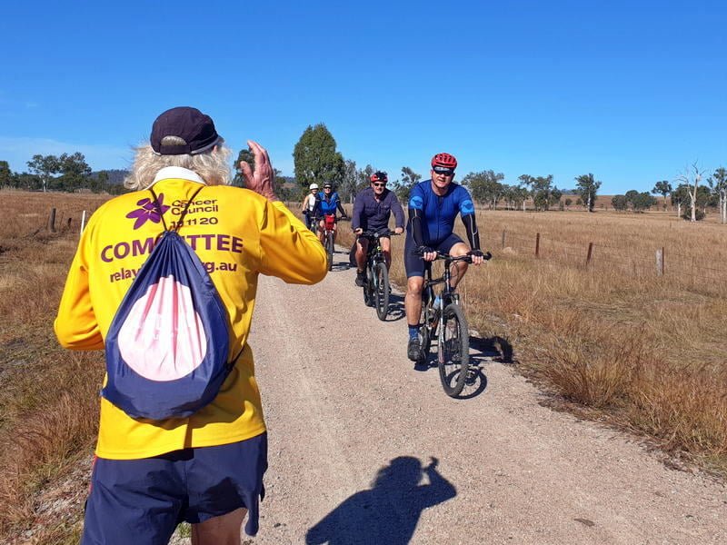
On the trail we were only two walking. We were passed by 25 Cyclists.
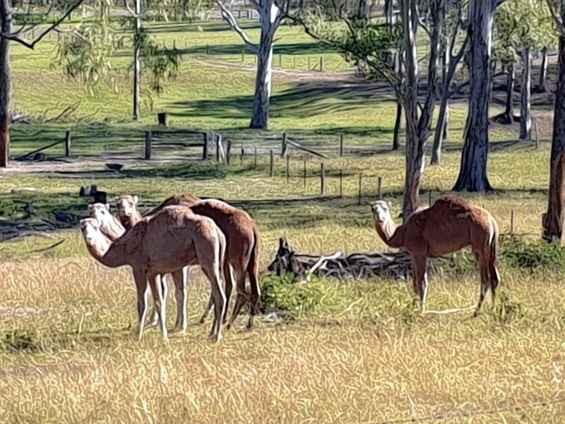
We saw very little wildlife and surprisingly no kangaroos – There were the usual cows watching our every move, a few small brown butterflies, 4 camels, 2 Eagles, 2 pelicans, one mouse and a stick insect.
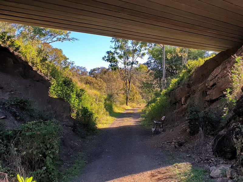
There is a very convenient bench seat in the shade where the trail passes under the Brisbane Valley Highway. Made for a great place to stop for lunch. I did loose my phone here and did some extra distance going back to find it sitting on the bench.
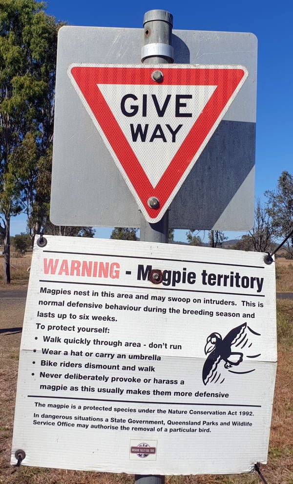
Magpies are obviously a problem in these parts with a few signs warning of magpie attacks. During Our walk however I don’t recall seeing any at all.

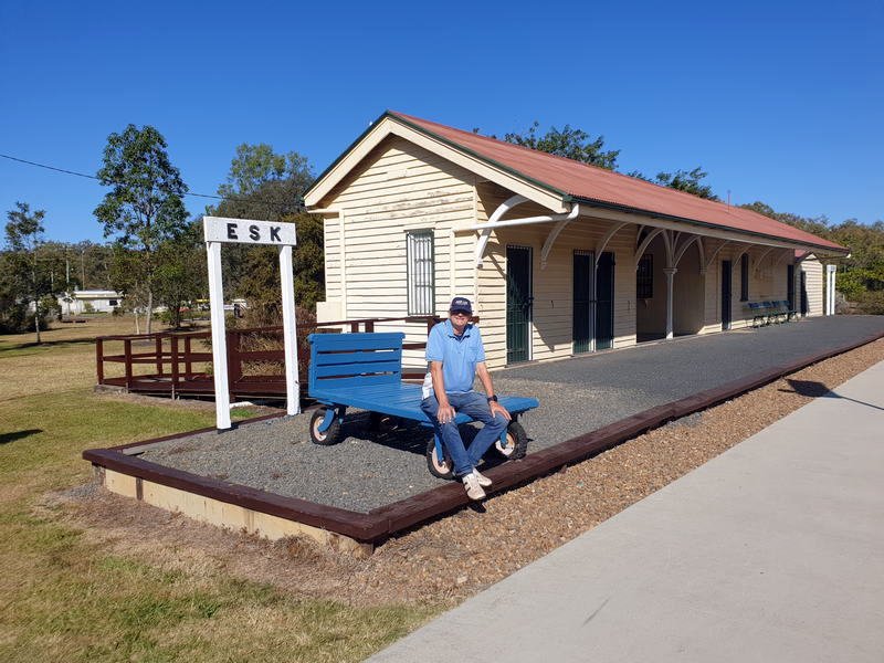
We were back in Esk by early afternoon. The Esk railway station is nicely restored and located in a recreational area with a children’s playground and surrounded by parkland.
Slide Show of Trail Photos
A pleasant walk and we are looking forward to taking on another section as soon as we are able.
Click the link for a pdf map of the trail – Trail Map